Amorgos
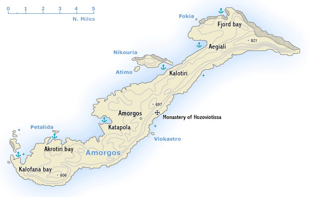 Αμοργός is spectacular island of bare rocky hills 33 km long and up to 6.5 km wide. For the most part the south-east coast falls steeply down to the sea, but the north-west coast is gentler, with two deep inlets – the sheltered Katapola bay and Aegiali bay and several coves like Fjord cove, Kalofana bay and Akrotiri bay proofing that Amorgos should be included in itineraries on a sailing holiday. The population – much reduced by emigration – lives by farming and fishing. Ferries are not frequent, which explains the surprising low numbers of tourists.
The remains of several ancient cities, extensive cemetery areas, finds of coins and rock inscriptions bear witness to the importance of the island in Minoan and Hellenistic times as a port of call on the sea route between Milos and the south-eastern Aegean. Used in Roman times as a place of exile and in subsequent centuries frequently harried by pirates, Amorgos has remained since then an island of no economic or political importance and has in consequence retained much of its distinctive character.
Amorgos
Hydra
 The Hydra gulf lies between the saronic gulf and the argolic gulf and is a one of the most popular yacht charter areas in Greece. The island of Hydra - Ύδρα (ancient Hydraea) itself is a bare monolithic ridge of limestone, 12 km long by 5 km wide, lying off the south-east coast of the Argolid. Arid and infertile, it lives mainly from the tourist trade and the sale of craft products (jewellery, pottery, embroidery, hand-woven cloth, leather-work). A tempting local speciality is the almond cake called amygdalote.
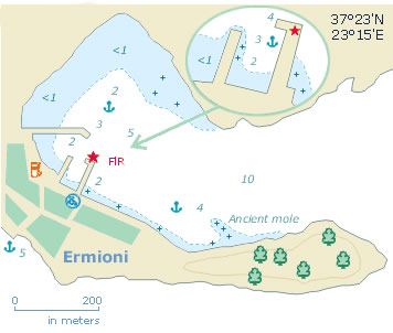
North-west of Hydra is the little grazing island of Dokos (the ancient Aperopia), with the village of the same name in a sheltered bay on the north coast. The mainland (in fact the Peloponnese peninsula) features many interesting anchorages and the handsome village of Ermioni.
Hydra


